搜索结果: 1-12 共查到“航空、航天科学技术 Satellites”相关记录12条 . 查询时间(0.14 秒)

CHALLENGES IN OPERATIONS AND MAINTENANCE OF ANTARCTICA GROUND STATION FOR EARTH OBSERVATION SATELLITES
Data Reception system (DRS) Data Communication System (DCS) Payload (PLD) Telemetry and Tele-Command (TTC) Visible Orbits
2019/2/27
Remote sensing and Geographical Information System (GIS) through Earth Observation (EO) Satellites have become most important tools for many of the societal applications of day-to-day life, during the...
COMPARISON AND ANALYSIS OF ACCURACY OF ELEVATION EXTRACTION BASED ON THE ZY-3 01 AND 02 SATELLITES STEREOSCOPIC IMAGES
ZY-3 Stereoscopic Satellite GSD DEM differential DEM, Accuracy
2018/5/16
The ZY-3 is the civil high-resolution optical stereoscopic mapping satellite independently developed by China. The ZY-3 constellation of the twin satellites operates in a sun-synchronous, near-polar, ...
COMBINED USE OF POLAR ORBITING AND GEO-STATIONARY SATELLITES TO IMPROVE TIME INTERPOLATION IN DYNAMIC CROP MODELS FOR FOOD SECURITY ASSESSMENT
Remote Sensing Agriculture Monitoring
2015/7/29
Use of satellite data in crop growth monitoring could provide great value for regional food security assessments. By using the difference
between remotely sensed crop canopy temperature and the corr...
Range Biases on the WAAS Geostationary Satellites
Range Biases WAAS Geostationary Satellites
2015/6/26
Due to limited receiver bandwidth and tracking configuration differences, measurements made on a narrowband geostationary satellite signal may differ significantly from those made on GPS signals and r...
Signal Deformations On Nominally Healthy GPS Satellites
Signal Deformations Nominally Healthy GPS Satellites
2015/6/26
This paper describes the collection and analysis of real data from twenty-four current, nominally healthy GPS satellites in the context of the ICAO second-order step (2OS) fault model.
Alternative Characterization of Analog Signal Deformation for GNSS‐GPS Satellites
Analog Signal Deformation GNSS‐GPS Satellites
2015/6/24
Currently, analog signal deformation is described using individual-chip step response curves for each GPS/WAAS-GEO satellite. Such a set of curves is helpful– it allows us to have an overall idea of t...
Using Outage History to Exclude High-Risk Satellites from GBAS Corrections
High-Risk Satellites GBAS
2015/6/24
GNSS augmentation systems that provide integrity guarantees to users typically assume that all GNSS satellites have the same failure probability. The assumed failure probability is conservative such t...
Using Outage History to Exclude High-Risk Satellites from GBAS Corrections
Outage History Exclude High-Risk Satellites GBAS Corrections
2015/6/24
GNSS augmentation systems that provide integrity guarantees to users typically assume that all GNSS satellites have the same failure probability. The assumed failure probability is conservative such t...
Committee of Earth Observation Satellites(CEOS)
Committee of Earth Observation Satellites CEOS
2014/4/16
Mission: CEOS ensures international coordination of civil space-based Earth observation programs and promotes exchange of data to optimize societal benefit and inform decision making for securing a pr...

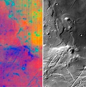
There is much more water on the Moon than previously thought, according to scientists who have analysed data gathered by three different space missions. Data from one mission show that water is retain...


